Description
PQWT-GT Series is the 8th-generation of multi-channel prospecting instrument newly developed by our institute based on theprinciple of natural electric field frequency selection method. It is widely used in underground water sources, geologicalstructures, mine veins, mine tunnels, cavities, karst caves, ant holes, mined-out areas, dam pipe surge, landslides and other fields.
FEATURES AT A GLANCE

GT150A – 150m
GT300A – 150m/300m
GT500A – 150m/300m/500m
GT1000A :500m/800m/1000m
GT1500A :500m/1000m/1500m
GT2000A:500m/1000m/1500m/2000m
GT3200A:500m/1000m/1500m/2000m/3200m


PRODUCT SPECIFICATIONS
New PQWT-GT 2000A Geology Exploration 2000m Deep Underground Water Detector Groundwater Finder
The PQWT-GT Series is the 8th-generation of multi-channel prospecting instrument newly developed by our institute based on the principle of natural electric field frequency selection method. It is widely used in underground water sources, geological structures, mine veins, mine tunnels, cavities, karst caves, ant holes, mined-out areas, dam pipe surge, landslides and other fields.

|
item
|
value
|
Data
|
|
Warranty
|
2 years
|
37.5KW
|
|
Type
|
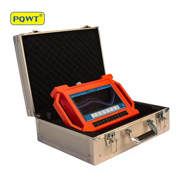
PWQT-GT New Underground Water Detector
|
2.8 M3
|
|
Customized support
|
OEM
|
125Ton
|
|
Place of Origin
|
China
|
96kN
|
|
Brand Name
|
PQWT
|
96kN
|
|
Model Number
|
PQWT-GT Series
|
60kN
|
|
Product name
|
PQWT-GT Series Under Ground Water Detector
|
6750ml
|
|
Application
|
Underground Water Detection
|
500N.m
|
|
Warranty
|
2 years
|
|
|
Usage
|
Borehole drilling, Mineral detection, Geological survey
|
|
|
Power supply
|
Rechargeable Lithium Battery
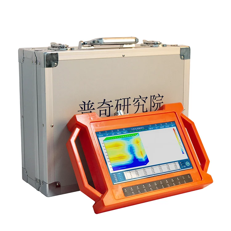
|
|
|
Display
|
10.1 inch HD Touch LCD
|
|
|
Max. number of Channels
|
18 channels
|
|
|
Min. resolution
|
0.001mV
|
|
|
Electrode
|
22pcs
|
|
|
Host Weight
|
1.95kg
|

This series of instruments integrates 5 independent invention patents of PQWT, including data acquisition system, data processing system, automatic mapping system, auxiliary analysis system and circuit system. It realizes the simultaneous data acquisition of multi-channel and multi-frequency, completely solves the influence of unstable factors caused by the time difference of the natural electric field source, and greatly improves the accuracy and work efficiency. The instrument can process the collected data, automatically draw curve map, profile map, and 3D renderings in real time, and automatically analyze abnormal areas, so as to provide scientific basis for analyzing geological structures quickly and effectively.
PRODUCT CONFIGURATION


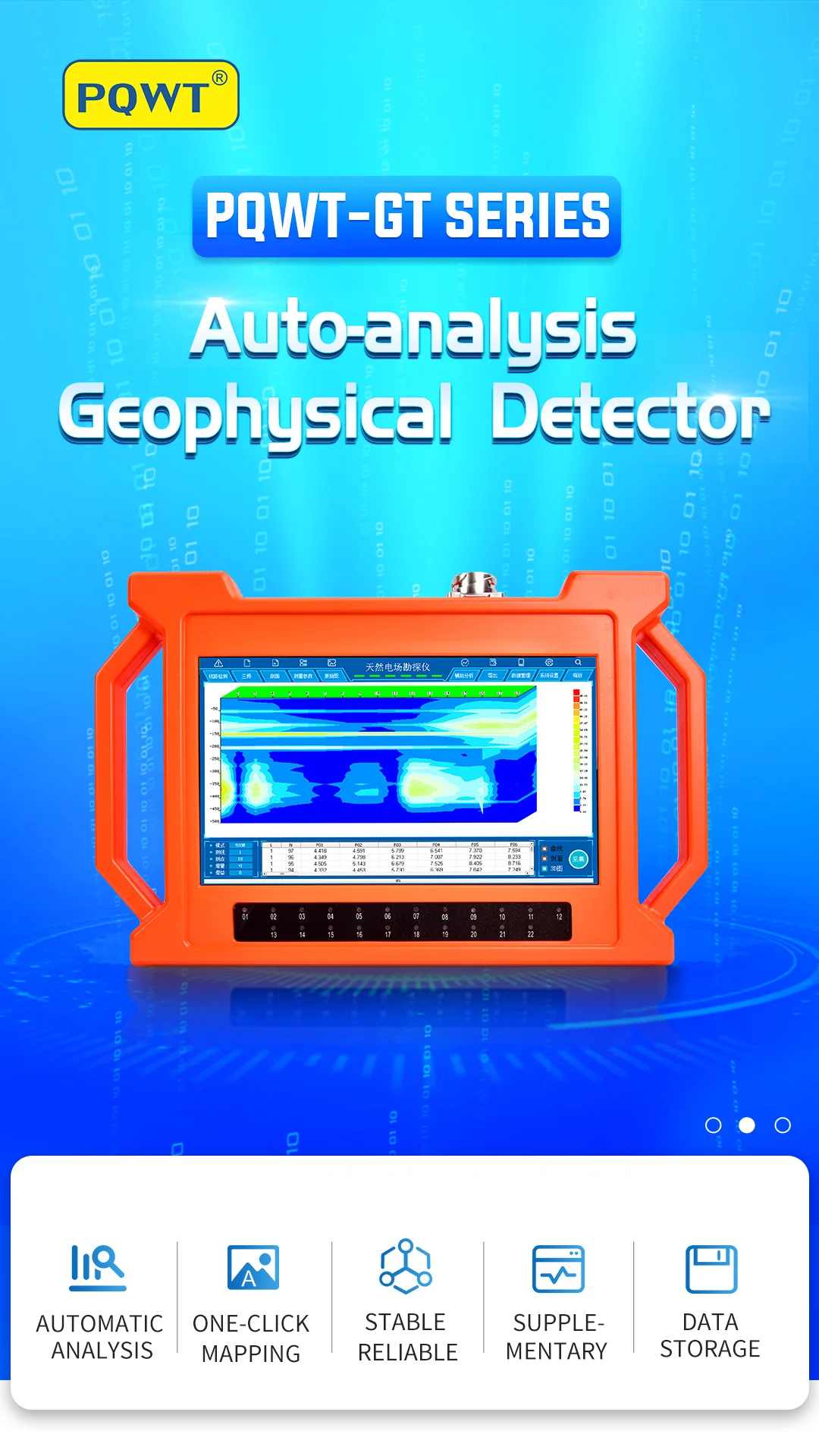
Auxiliary analysis: The instrument analyzes the abnormal area with one click.
Automatic mapping: Automatically draw curve map,profile map, and 3D renderings.
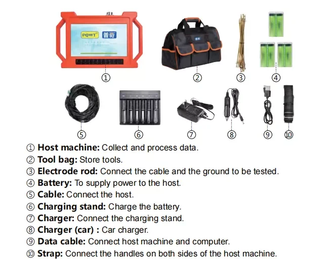
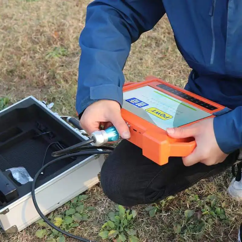
Stable and reliable: Collect 18 points data with one-time wiring.
Supplementary measurementfunction: The extension of geological structure can be analyzed by making supplementary measurement in front and rear of thesurvey line.
Data storage: It can store curve map, profile map, and 3D renderings of more than 999 survey lines to facilitate the production of geophysical exploration reports.


Product Components
① Host machine: Collect and process data.
② Tool bag: Store tools.
③ Electrode rod: Connect the cable and the ground to be tested.
④ Battery: To supply power to the host.
⑤ Cable: Connect the host.
⑥ Charging stand: Charge the battery.
② Tool bag: Store tools.
③ Electrode rod: Connect the cable and the ground to be tested.
④ Battery: To supply power to the host.
⑤ Cable: Connect the host.
⑥ Charging stand: Charge the battery.
SALES AND SERVICE NETWORK

Successful Project


Reviews
There are no reviews yet.